by Ranjit S. Sahai, PE, F.ASCE
Construction is stalled. A change in field conditions necessitates a design update. Engineer conceives a remarkable solution with no impact on project cost or schedule. A sketch communicates the proposed concept but the owner needs to visualize it juxtaposed against surroundings for line-of-sight alignments that can only be assessed in a 3D environment. How can this be done on the spot, while in the field, to eliminate the 2-week visualization effort? Sensory-spatial modeling to the rescue.
The visualization took an hour; not two weeks. The discovery of changed field conditions that necessitated a design update had been resolved without impact to schedule by eliminating the traditional visualization step by simulating the design juxtaposed against its real surroundings.
Let’s examine the above scenario in the context of a workflow enabled by sensory-spatial modeling, the emerging revolution in engineering design and construction.
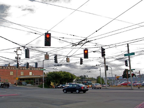
The design to upgrade traffic control signals at an urban street intersection had required the installation of three new traffic signal poles. The location, height, and type of poles were chosen to accommodate the cluster of overhead utility cables.
It had taken two-years for construction funding to come through. When construction started, it was observed that clearance under overhead communication cables at two locations were 2-feet lower than when designed.
The solution requires changes in location of poles based upon their type: standard vs tee. The owner loved the concept but needed verification of under-clearance and driver line-of-sight parameters.
A sensory-spatial modeling enabled workflow eliminates distance measurement and removes the gap in time between concept selection and its visualization. Let’s see how.
The act of envisioning possible options and developing a creative solution requires cognitive thought that only a human mind with experience in the field can deliver.
In this instance, the contractor noted that he had already procured the three poles designed; and that it would take four weeks to procure new ones, if called for. Fortunately, the engineer discovered that switching poles between the design locations accommodated the lower utility clearances while satisfying design parameters. This meant that changes to design were limited to changing pole types and concomitant construction notes.
With the street intersection in full-view and the overlaid proposed design also visible concurrently as an overlay, through a device such as the Microsoft HoloLens, the engineer is able to use gestures to move proposed design elements – which in turn adjust the design model in real-time.
With the adjustments made, the contractor and the owner can put on the mixed reality modeling glasses and review the design before the field meeting is over. This makes possible significant savings in time from concept to visualization.
Next month we will look at how this and other technologies are leveraging design models to automate construction.


